SYDNEY WALKS
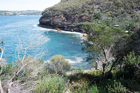
The roofs of the historic huts can be seen in this picture of Crater Cove. Picture: © Sydney.com.au
How to get to Crater
Cove Walking Track
Google map showing path to Craters Cove
Crater Cove is on the rocky foreshores of Dobroyd Head at the entrance to Middle Harbour. It lies within the Sydney Harbour National Park and accessible only by foot. Getting to Crater Cove is not easy but the reward of seeing the huts in the cove setting is well worth the effort.
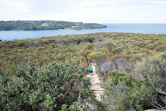
The Crater Cove Walking Track is not signposted so you need to know precisely where to look in order to find the path. We explain below how to find the track. The latter part of the walk is on a rough track through overgrown brush and along rocky terrain, and involves some scrambling over rocks.
We've broken the directions into two parts: The first part will get you (via public transport) from the Sydney CBD to Dobroyd Scenic Drive, where the walk begins, and the second part will guide you on the walk into Craters Cove.
The walk into Crater Cove is perhaps 50-70 minutes, including the walk from the bus stop. You don't need to be overly fit to do this walk. If you have a disability, however, this may not be the walk for you.
Part 1: Sydney CBD to Dobroyd Head by bus, then walk to Dobroyd Scenic Drive
From Carrington Street, beside Wynyard Station, take the 180 bus towards Collaroy Plateau. The 180 service runs roughly every half hour each day of the week, and starts at 6.30am Mon-Fri and 7.30am Saturday. (Check timetables for updates) Exit the 180 bus in Sydney Road, Balgowlah Heights, just after Dudley Street, and catch the 132 bus towards Manly.Exit the 132 bus at Curban Sreet (near Concise Street) in Balgowlah Heights and walk to Dobroyd Scenic Drive.
If you have access to Google Maps on a mobile phone, search for Dobroyd Scenic Drive and walk to the point where it meets the start of the Dobroyd Head Track, which is where you start the walk into the cove.
If you don't have access to Google Maps, follow these directions:
After alighting from the bus walk south down Curban Street and turn right into Beaconview Street. Walk to the end of Beaconview Street and turn left into Dobroyd Road, and walk to Heathcliff Crescent. Turn left into Heathcliffe Crescent and walk until you come to Elevation Avenue. Turn right into Elevation Avenue and follow it until you come to Fisher Street. Turn right into Fisher Street, which leads to Dobroyd Scenic Drive. Turn left into Dobroyd Scenic Drive and follow the road around Tania Park, past Arabanoo Lookout. Continue for 200 metres until you see a huge expanse of rock on the left-hand side of the road. At the end of the rock is a white wooden guard rail fence. Follow the fence and you will come to a clearing with a Dobroyd Head signpost. The Dobroyd Head Track, which leads to the Dobroyd Head Lookout, starts here. Standing in the road and looking out across the harbour, turn left onto Dobroyd Head Track and follow the signposts. This is the route on a map.
Part 2: Getting to Crater Cove (with pictures)
Follow the Dobroyd Head Track towards Dobroyd Head for about 450-500 metres. After 15-20 minutes you will see North Head in the distance. At this point you are not far from the Crater Cove Walking Track turn-off.
Soon you will come to a signpost, which looks like this:

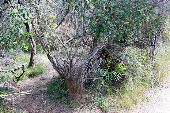
Now, this is the tricky part of the walk. The signpost points to a path leading off to the left, to Beatty Street. DO NOT take this path. The path you need to take is a further three metres on and off to the right in a small clearing - it's not signposted and partly hidden by brush. This is the Crater Cove Walking Track. This is what the start of the track looks like.
Follow this track all the way to Crater Cove. It's scrambly and bushy, and you'll end up doing some rock hopping, but there is just the one track and it leads directly to the cove.
If you go back to the Crater Cove webpage you can follow the walk into the cove in pictures. You can also plot your path with Google Maps.